Larapinta Trail Wrap Up
I came back to reality last Friday afternoon after wrapping up 13 days on the Larapinta Trail earlier that morning. This was the longest walk I've done to date, and is likely to be the longest walk I do all year (although there are some other pretty big cool walks planned). It was an amazing experience and I had a really great time.
I am going to try and provide some information about the Larapinta Trail and the hike more generally, and mix it in with specific stories about our time on the trail, to help build up a better picture of our trip.
I am still editing lots of photos and I will try and upload more of those later this week or early next week.
Cowboy Camp, Low Camp, High Camp
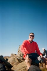
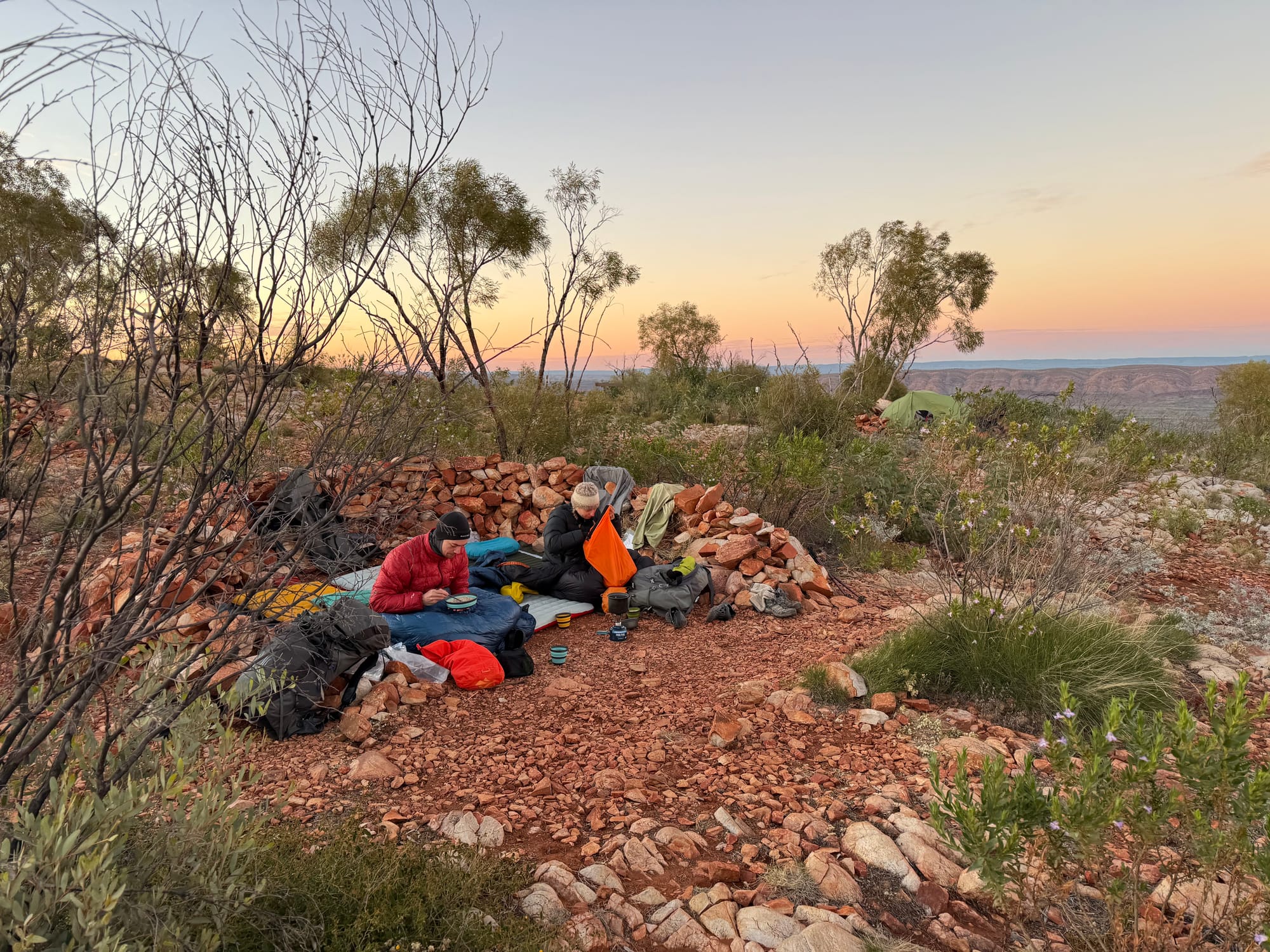
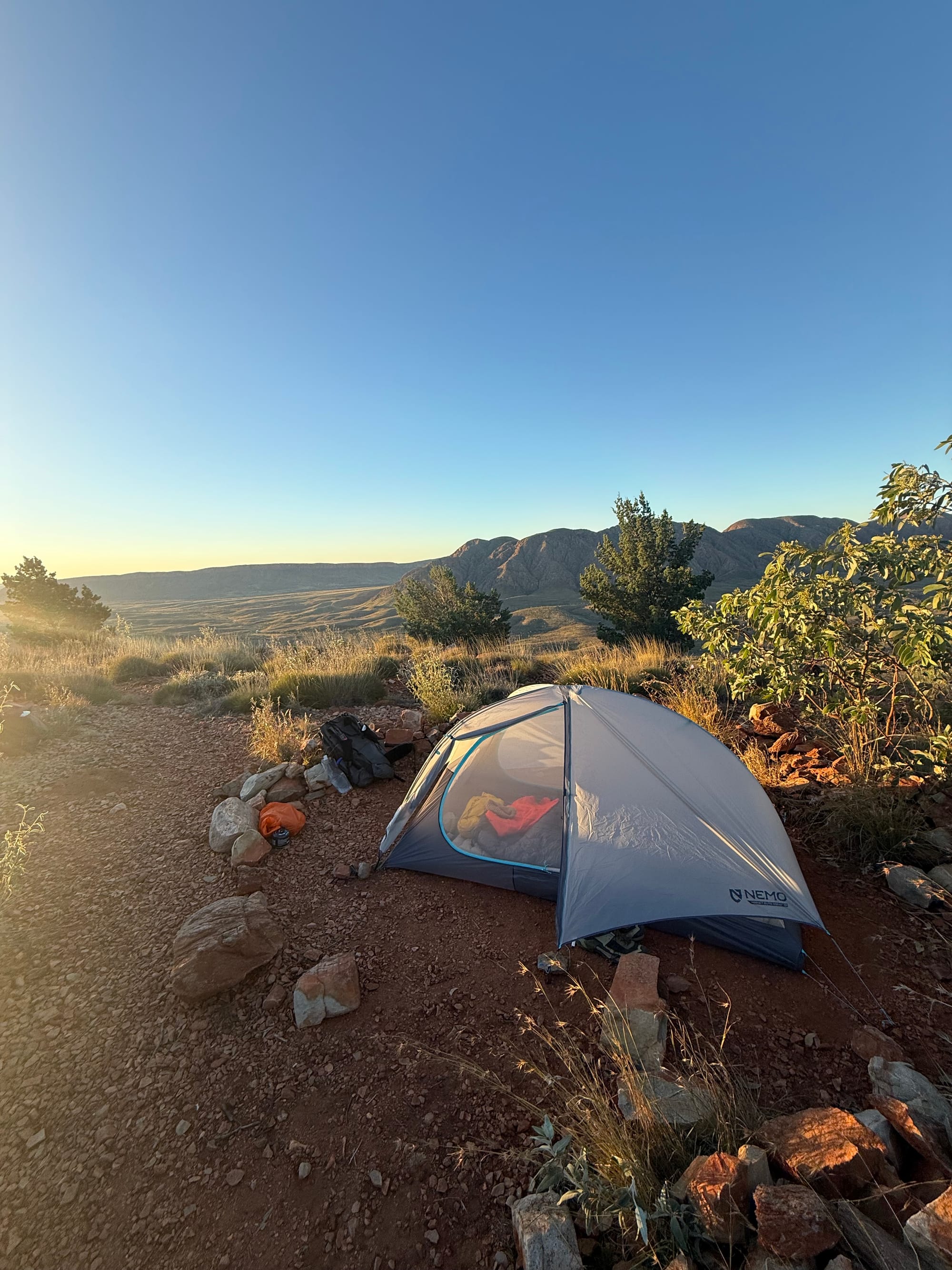
Cowboy Camping: Camping without a tent. Roll out a ground sheet, roll out your mat, roll out your sleeping bag and tuck into bed. This works well in the desert, as there is not much rain, it is never too windy, it is pretty dry so there aren’t many issues with dew, and there are no clouds, so the star show you get to look at each night is amazing. For our walk, Georgia went tentless and so cowboy camped every night. Hugh and I were keen to embrace being out in nature and so cowboy camped about half of the time. I have a pretty new tent and so I was keen to get some reps in in setting it up.
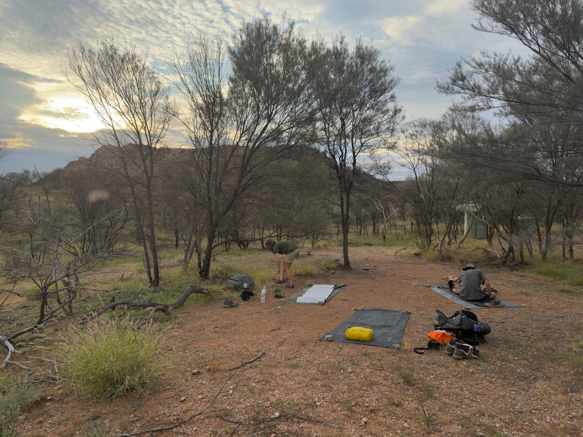
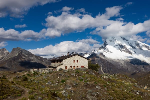
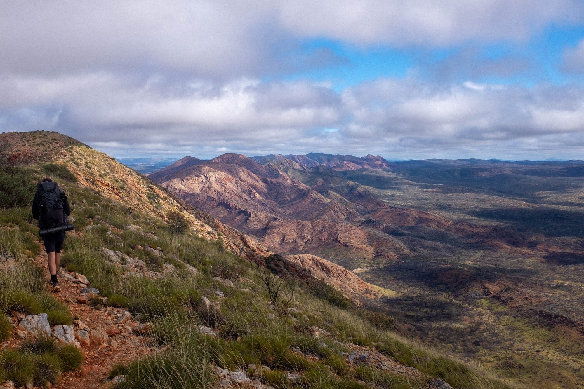
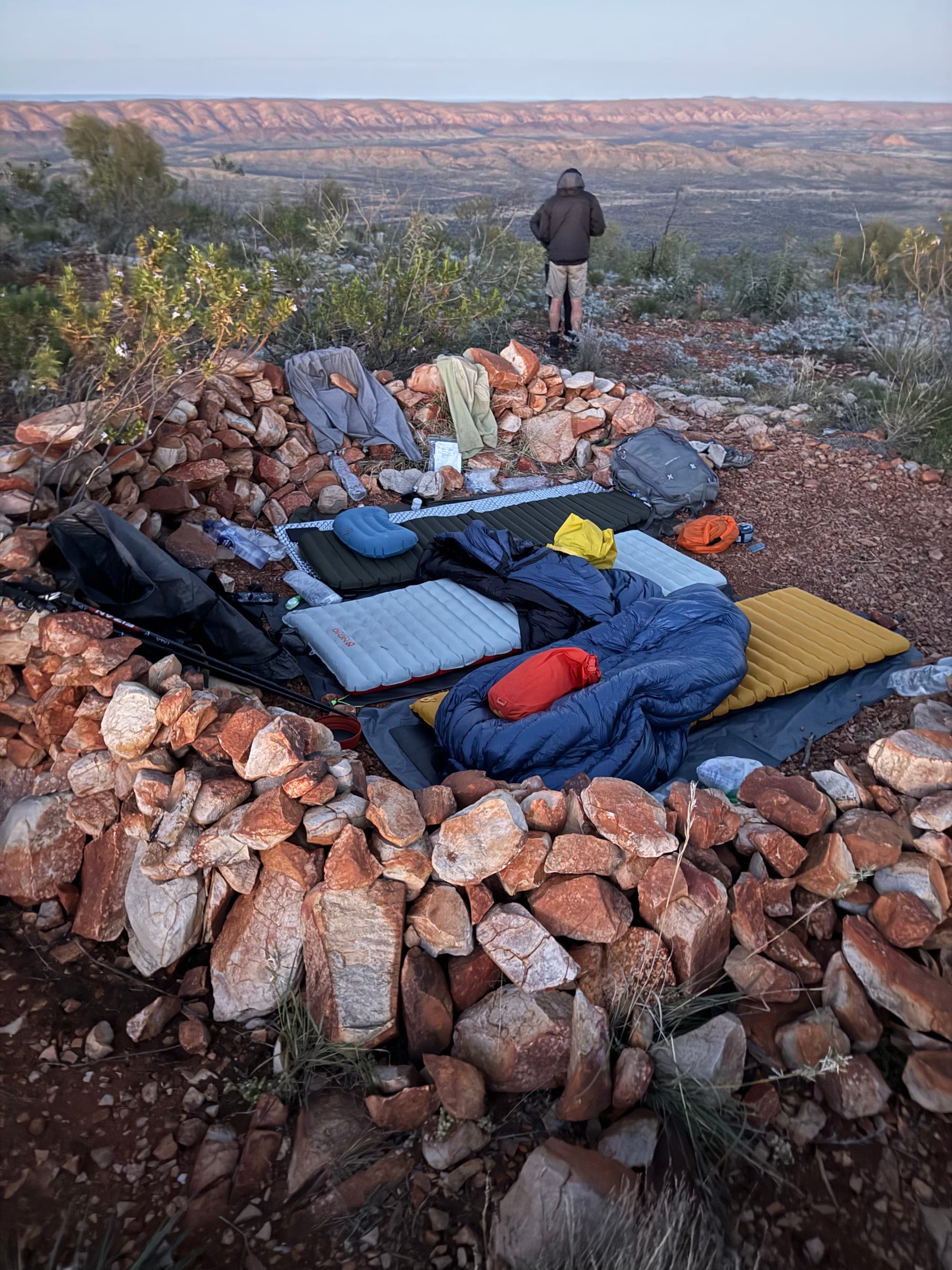
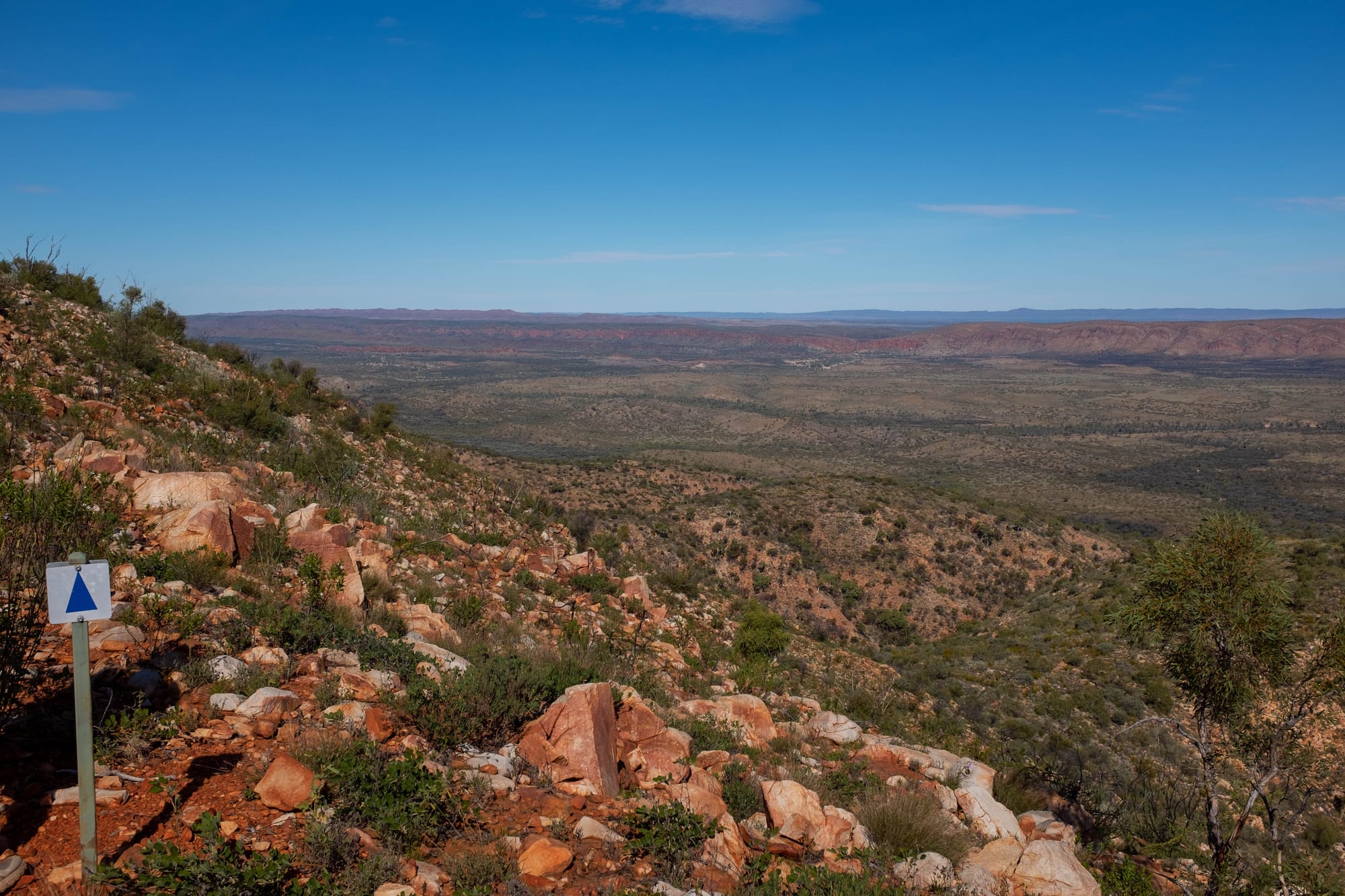
Low Camp: The Larapinta Trail is long and is broken into 12 sections. At each section junction (where one section ends and another starts) there is a shelter area with sleeping platforms (large wooden platforms underneath the shelter that you can pseudo-cowboy camp on), a couple of water tanks, a drop toilet, some normal campsites and a map that tells you some information about the trail on either side of the junction. While a lot of the walking on the trail was along, up and down the Western Macdonell Ranges, these shelter area campsites were always at the bottom of the mountain ranges in the valley. We referred to these shelter area campsites as low camps. Given the amenities they provide, and the even spacing of them across the trail, most walkers stay at the low camps each night. For the most part, the low camps were set up in cool locations, usually close to an interesting rock formation or a swimming spot. We camped at the low camps for about half of the time on trail.
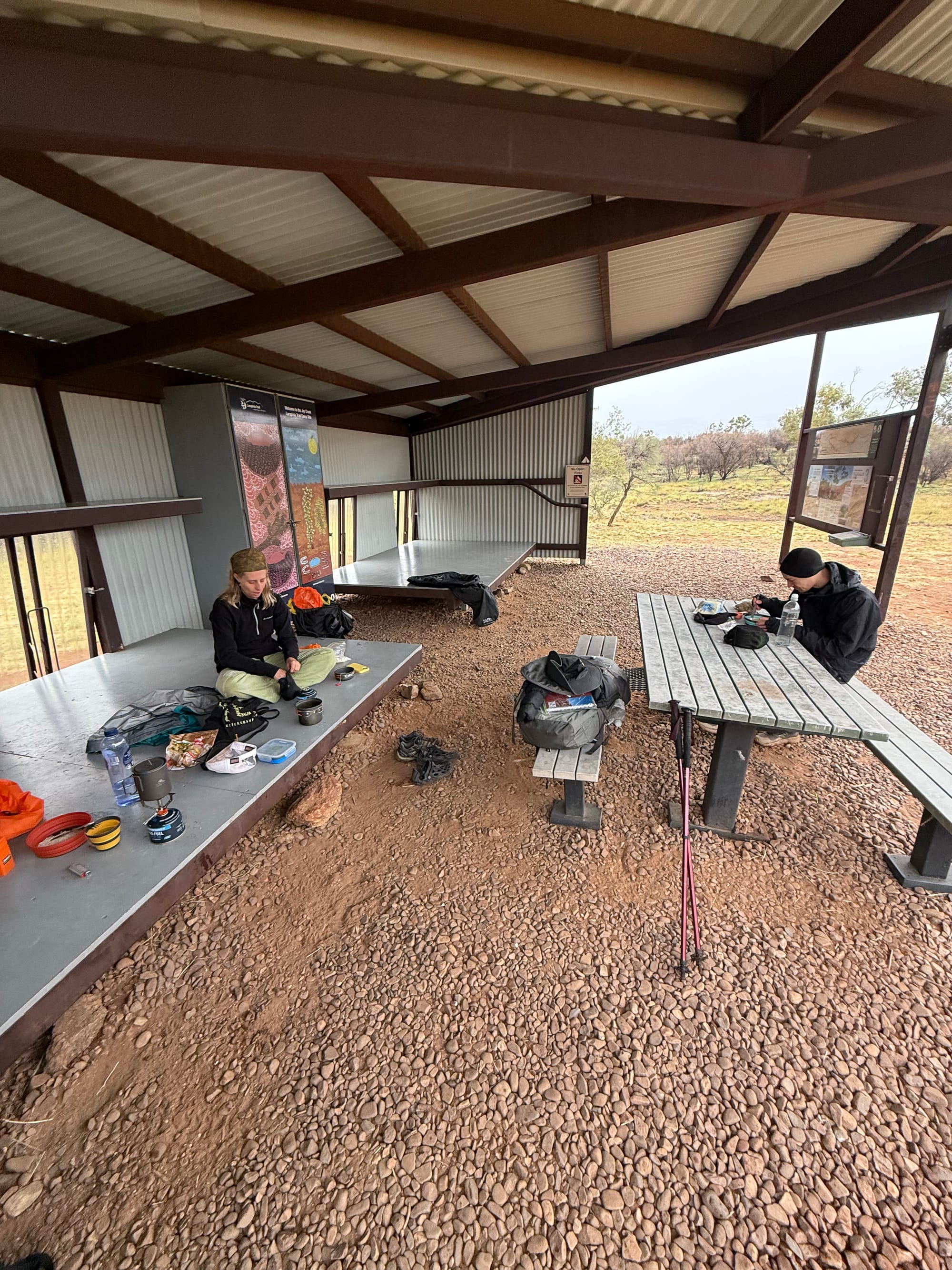
A typical low camp
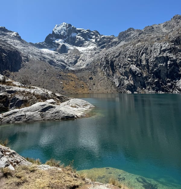
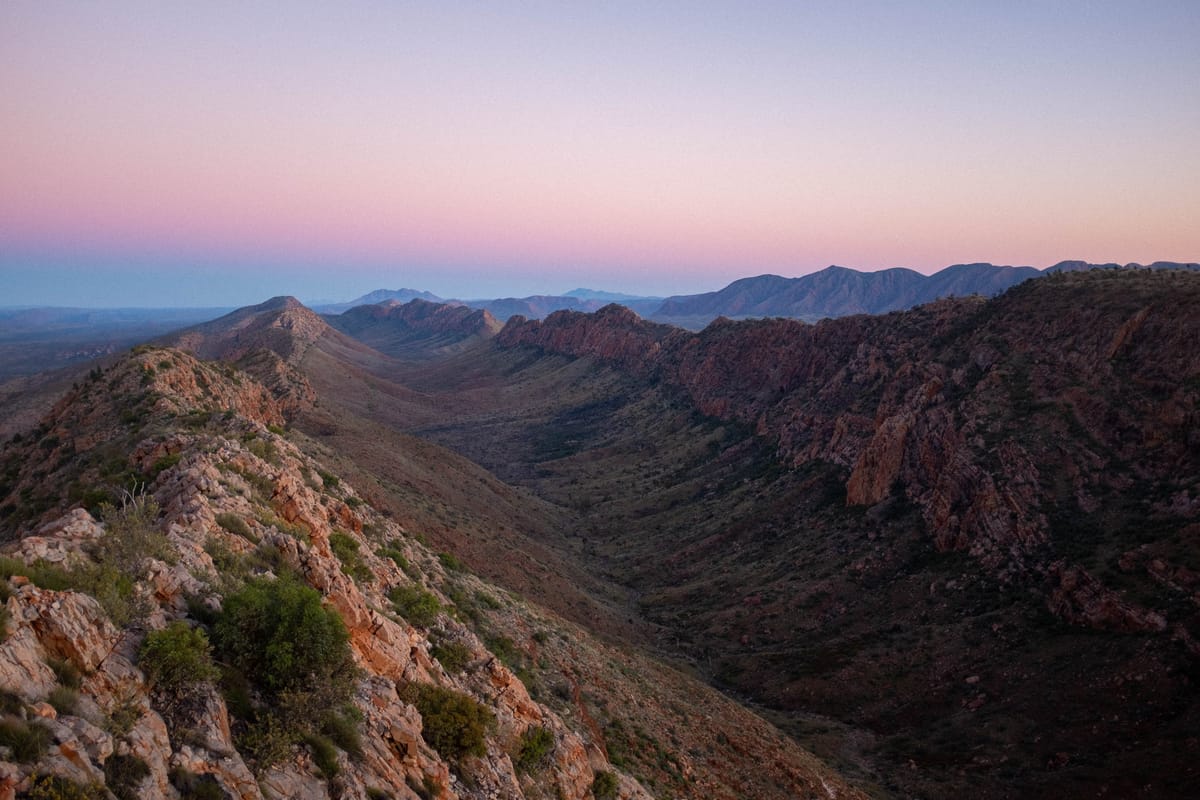
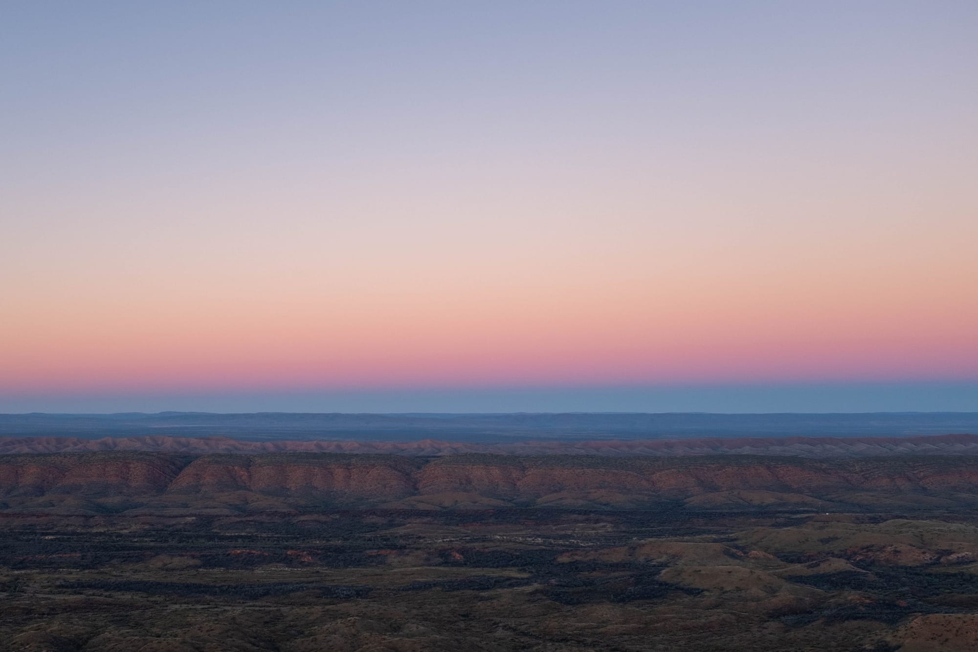
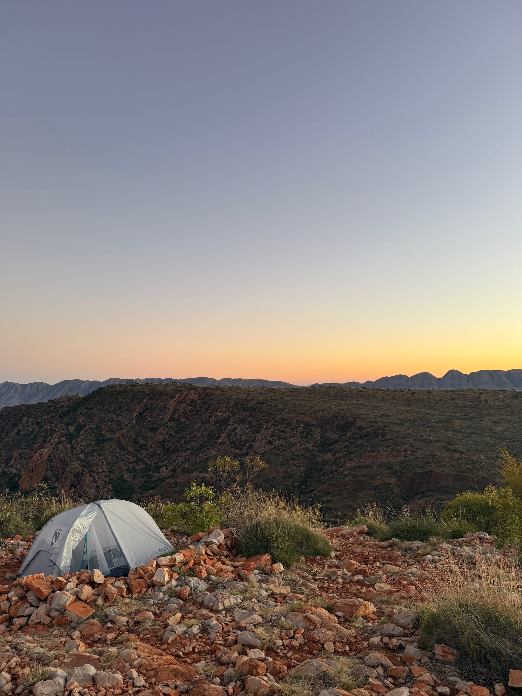
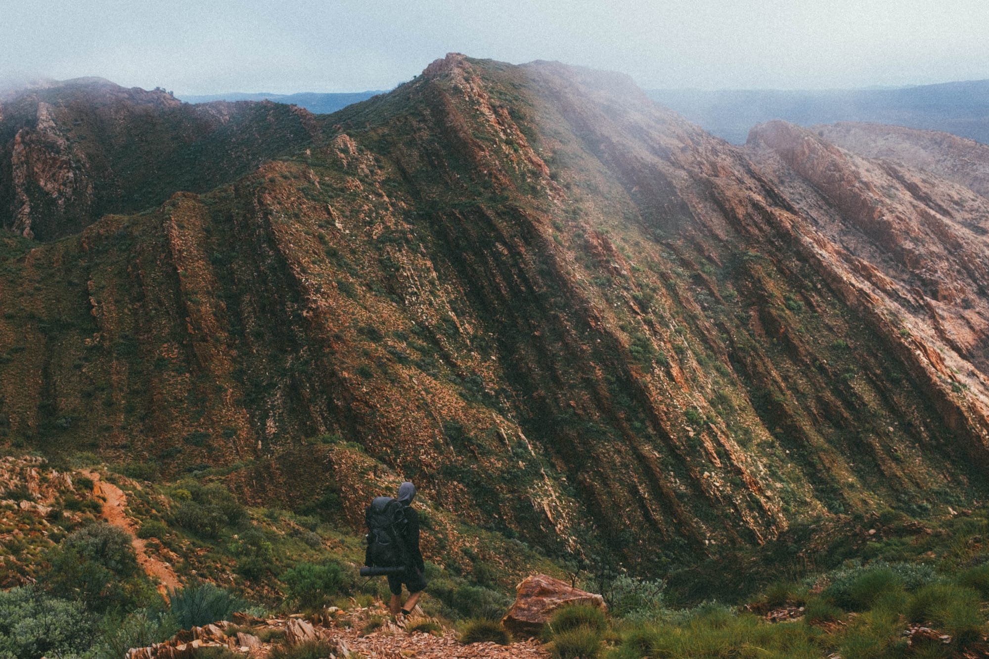
High Camp: For me, the real magic, and some of the best spots we stopped on the walk, were at the high camps. A high camp is a campsite that is up on the top of a mountain, along a ridge line, at a lookout etc. They give you 360-degree views, meaning the sunset and sunrise is amazing to see. As you could imagine, high camps are pretty exposed to the weather, so they aren’t a lot of fun if there’s too much wind. Additionally, they are much more basic in their setup compared with the shelter areas. The areas cleared for tents are small and rocky, there are no water tanks, so you have to fill up at the last shelter site you pass and carry extra water for a few kilometres up to the camp, there are no toilets, so you are getting a trowel and digging if you need to use the loo.
We stayed at 3 high camps on our walk (Counts Point, Mount Giles Lookout and Hilltop), each night it was extremely still, there was barely any wind, barely a cloud in the sky, so pretty perfect conditions for high camping. At these points on the trail there are no buildings, roads, anything man-made as far as you can look in every direction. Watching the sun rise or set and it being so still in the air was really calm and peaceful. Each time was a really special experience. The high camps stole the show for me. So then, you may be wondering, what happens when you combine a high camp with a cowboy camp..? More on that later.
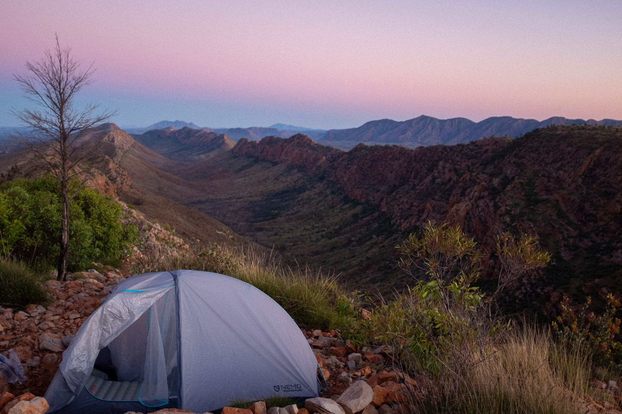
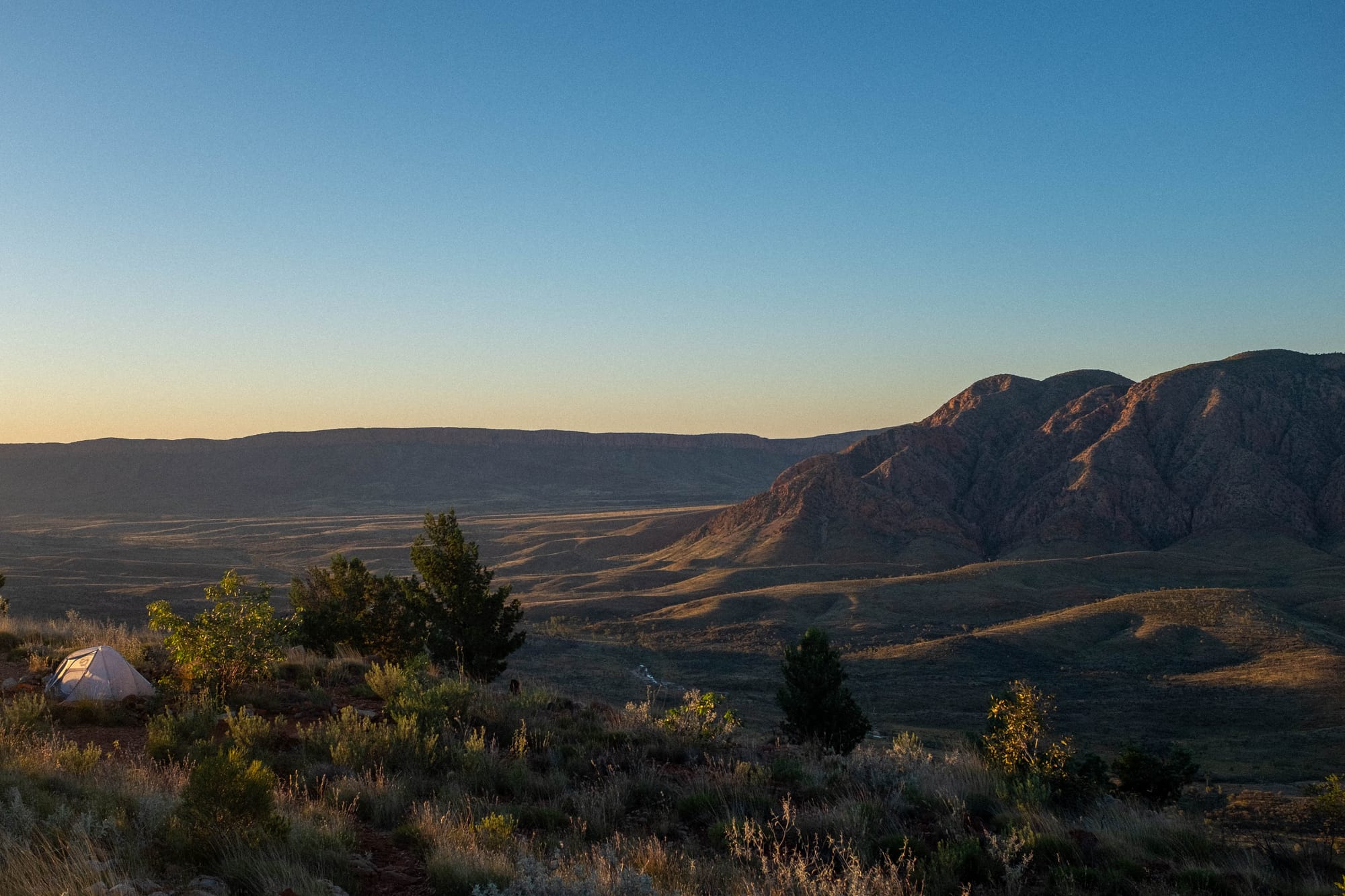
The high camps
Weather
Prior to starting the walk I could see on the forecast that we were due for a little bit of rain mid-way through the first week, on day 3 and 4 of our trip. The forecast amounts on the BOM weren’t anything to be too worried about, about 10-15mm each day. At the end of day 2, we arrived at our campsite for the night (Mulga Camp) and I pulled a weather forecast on my GPS. The rain was due to start mid to late morning the following day. Given this information and it had been a long day of walking, we decided to cowboy camp at camp that night.
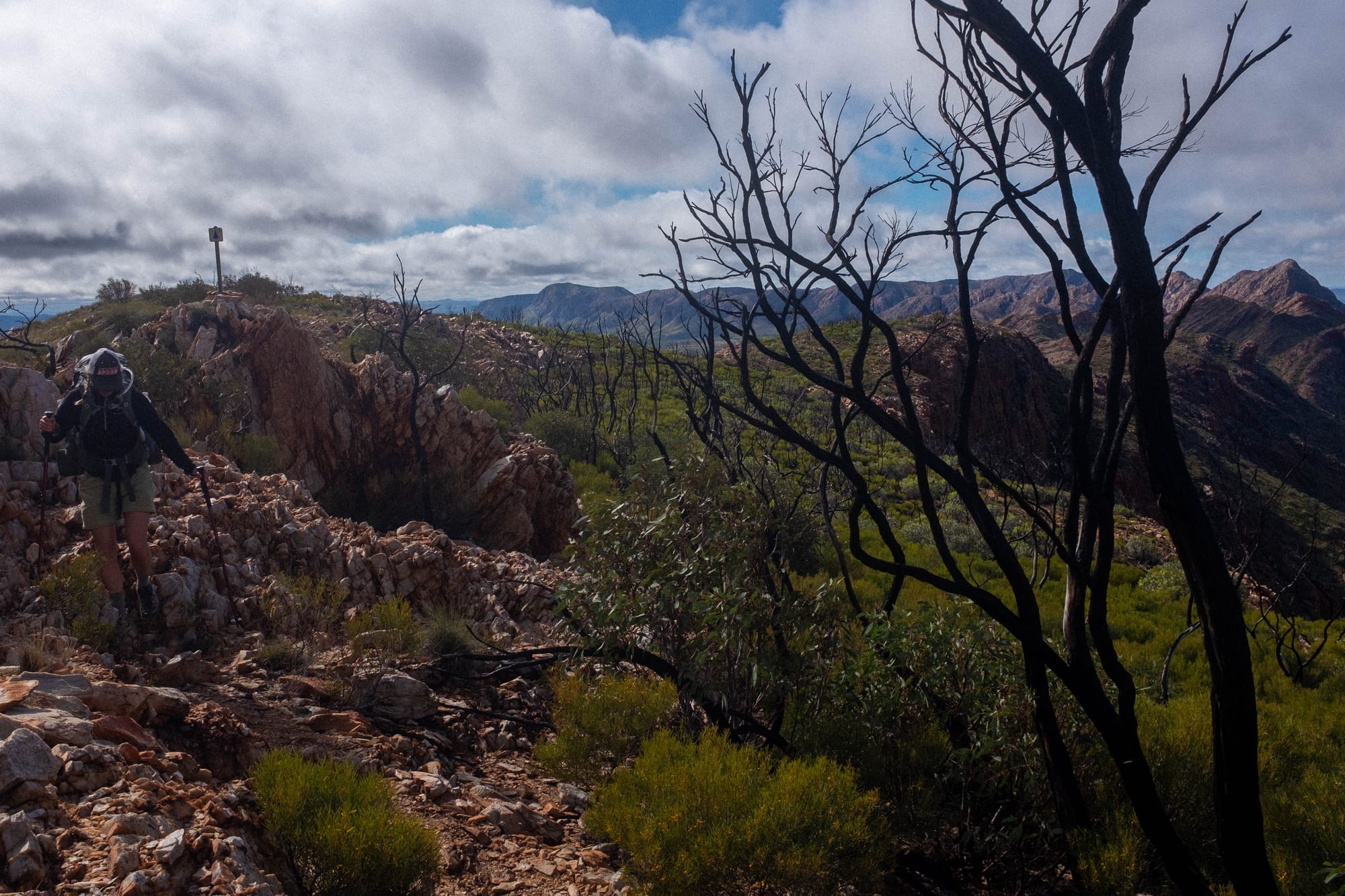
We were woken at about 4:30am to very light rain falling on us. It wasn’t clear if it was going to pass through or get heavier, so we made the call to pack up and start walking in the dark, a couple hours earlier than planned. After packing up, lining our packs, getting gear into dry bags and making a coffee, we were on the move at about 5:30. We made it to the 2/3 Section junction shelter (Jays Creek) after about 10km and had breakfast. The rain and wind really started to pick up from here, as we entered a particularly beautiful, rocky section of the walk. The next 15km was some seriously beautiful walking but also some pretty grim weather. Ever the optimist, Hugh’s take on the situation was that not many people would get to experience the Larapinta Trail the way we did that day.
The pot of gold at the end of the day for us was that that nights camp was at a proper campsite (Standley Chasm) with the promise of hot showers, a food and drink kiosk and plenty of undercover shelter.
I made notes after each day of walking, this is what I wrote for day 3, I think the visceral thoughts capture it best:
Day 3
Mulga Camp to Standley Chasm
23.5km | 520m elev.
- This was the most hectic day of hiking I’ve ever done
- 4:30am wake up as it was raining lightly, 5:00am packed up, quick coffee and snacks and started walking at about 5:45 in the dark with head torches on.
- Easy 10km to Jays Creek, rain was light but steady so put raincoats on at some point
- Jays to Standley 13km, 5.5hrs, absolutely spectacular, slow winding through dry creek beds, scrambling up rocky gorges, walking up over passes and dropping into new valleys to do it all again.
- Seriously beautiful rocks + plants in Fishhole Gap, really beautiful dry creek bed
- Weather starting to get really rough here, rain getting heavier, wind picking up, vibes staying really high in the group
- Walking through some really big, sparse valleys, tall red mountain faces either side, misty and wet, very unique feeling, very special, vibes amongst group really high. Feels more like Red Tassie than the NT
- Arrived at Millers Flat, with ~5.5km to go, we were absolutely soaked, morale being tested.
- Made it to Standley Chasm campsite with morale just barely in tact, kiosk still open so the reward for the gnarly day was a hot chocolate, scones and burgers.
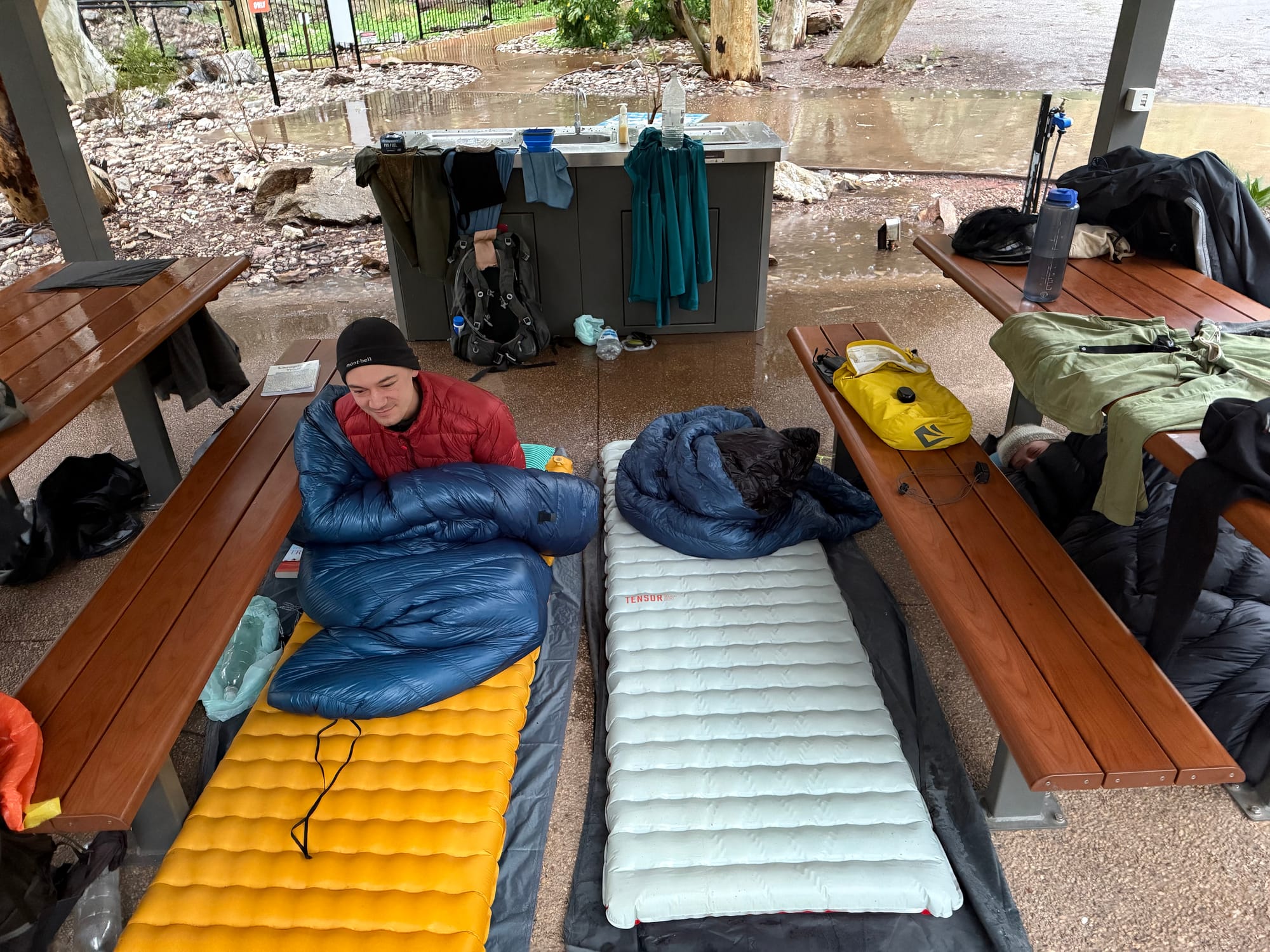
With hot food in the system and our gear starting to dry out, we couldn’t summon the energy to set up our tents in the pouring rain and face the wet again, so with the wind feeling pretty calm at Standley Chasm campsite, we made the call to cowboy camp under a picnic area shelter that was big enough for the 3 of us. This was a bad decision.
The volume of rain that came down that day meant that it was pooling around the slab of the picnic area, and after about one hour of sleep, it had breached the slab and began slowly flooding onto the slab. It reached Georgia’s sleeping spot, causing her to pivot to underneath a picnic table, a spot that was definitely not big enough for someone to comfortable sleep in, but was just about the only dry spot left under the shelter. As the night went on the rain and wind picked up again, blowing sideways enough to cover us all with a rainy mist that by morning had wet all of our sleeping gear. With another full day of rain forecast, all our gear soaked and morale starting to waver, we made some adjustments to our walking schedule on the fly, and bunkered down at Standley Chasm for all of day 4 to rest, eat more kiosk food, and dry out.
Looking at data on the BOM now, we received about 40mm of rain across those 24 hours. Historically, Alice Springs is supposed to get 20mm of rain across the entire month of May. This was a challenging 24 - 48 hours for us, and it was not what I had expected when I signed up for a walk in the desert, but like Hugh says, not too many people get to experience the Larapinta Trail in this way. By lunchtime on Day 5, the skies were clear of clouds and we had pretty well perfect weather for the rest of the walk, with barely even any breeze blowing or any clouds in the sky.
Dingo
Camp on Day 5 (Birthday Waterhole) was a lovely spot on a big sandy riverbank, next to a waterhole under a big gumtree - quintessential out bush spec. Our spirits were high after a full dry day of walking, and so we decided to cowboy camp. The following all happened whilst I was asleep and so it is based on recount provided by Hugh and Georgia:
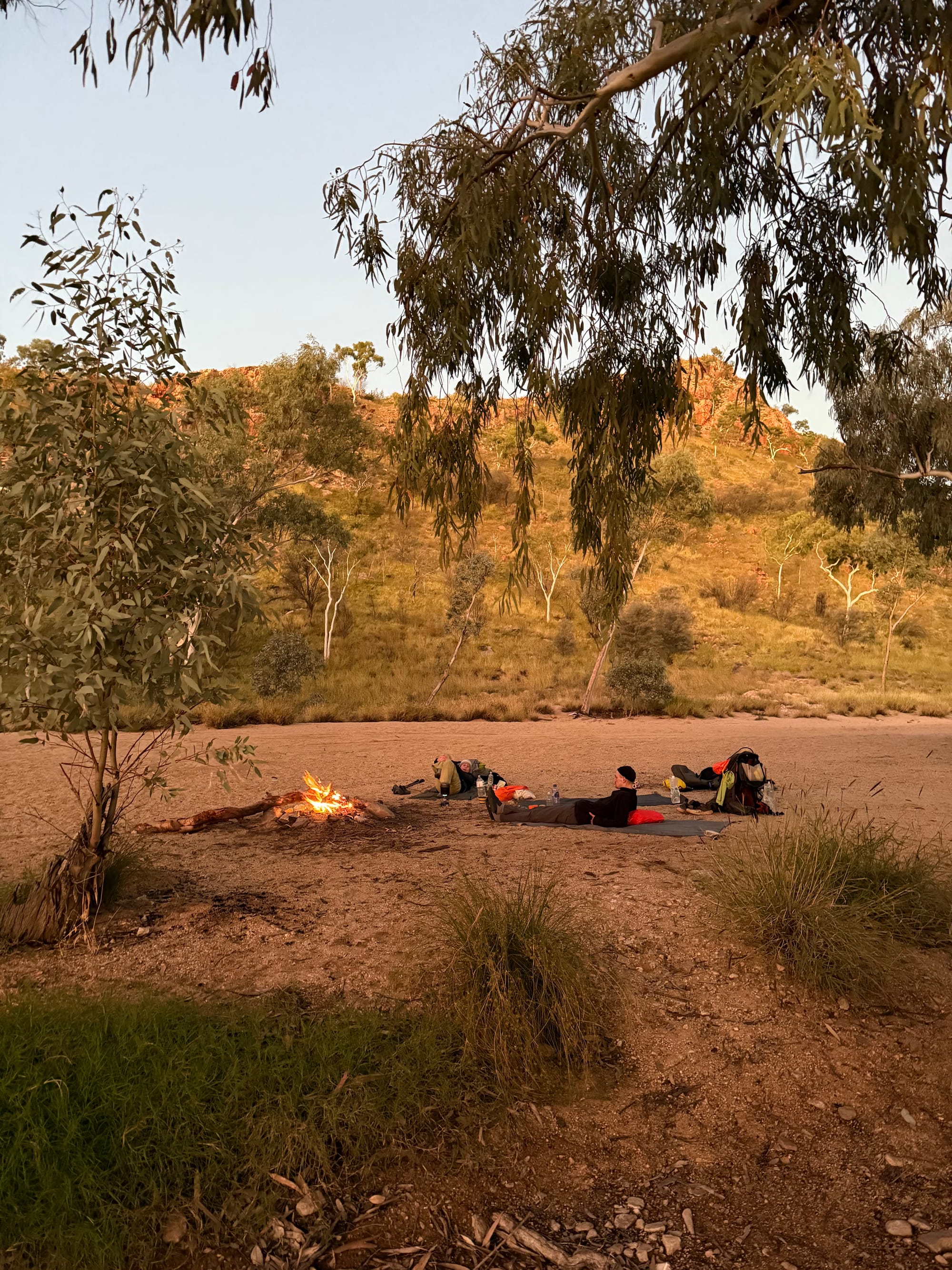
About an hour after we went to sleep, Hugh was awake looking at the stars and heard a growling noise further along the sandy riverbed. Hugh was whisper-shouting at me to wake up but I was deep in sleep and not responding. Georgia heard Hugh and woke up, and the noise was now a louder barking. Hugh grabbed his head torch and shined it at the noise, illuminating a dingo which was only about 20m away from where we were lying on the river bed. When the dingo saw the light it barked and growled a few more times and then ran away. Freaky! Georgia assured us that the dingo was unlikely to case any harm to us on its own, at worst it might have tried to have a poke through our packs for anything it might like to eat. That same night in the early hours of the morning, Georgia was awake and heard a pack of dingoes further off in the distance all howling.
The Ultimate Kickback
I am realising that the last couple of subheadings probably aren't painting the rosiest picture for the walk. I have to assure you that these were just little blips that really only increased the levels of excitement and adventure amongst us.
The significant majority of the trip was spent walking in what felt like an extremely remote and unique part of the country. There's something about the planning, preparation, the effort of doing the walking, the self-reliance of having everything you need on your back, the remoteness of locations you reach after days of walking (can you get much deeper in nature?) - all culminating in a feeling of satisfaction that is scarcely matched by anything else. I have found that completing a multi-day hike of any distance is always a really rewarding feeling. But I digress.
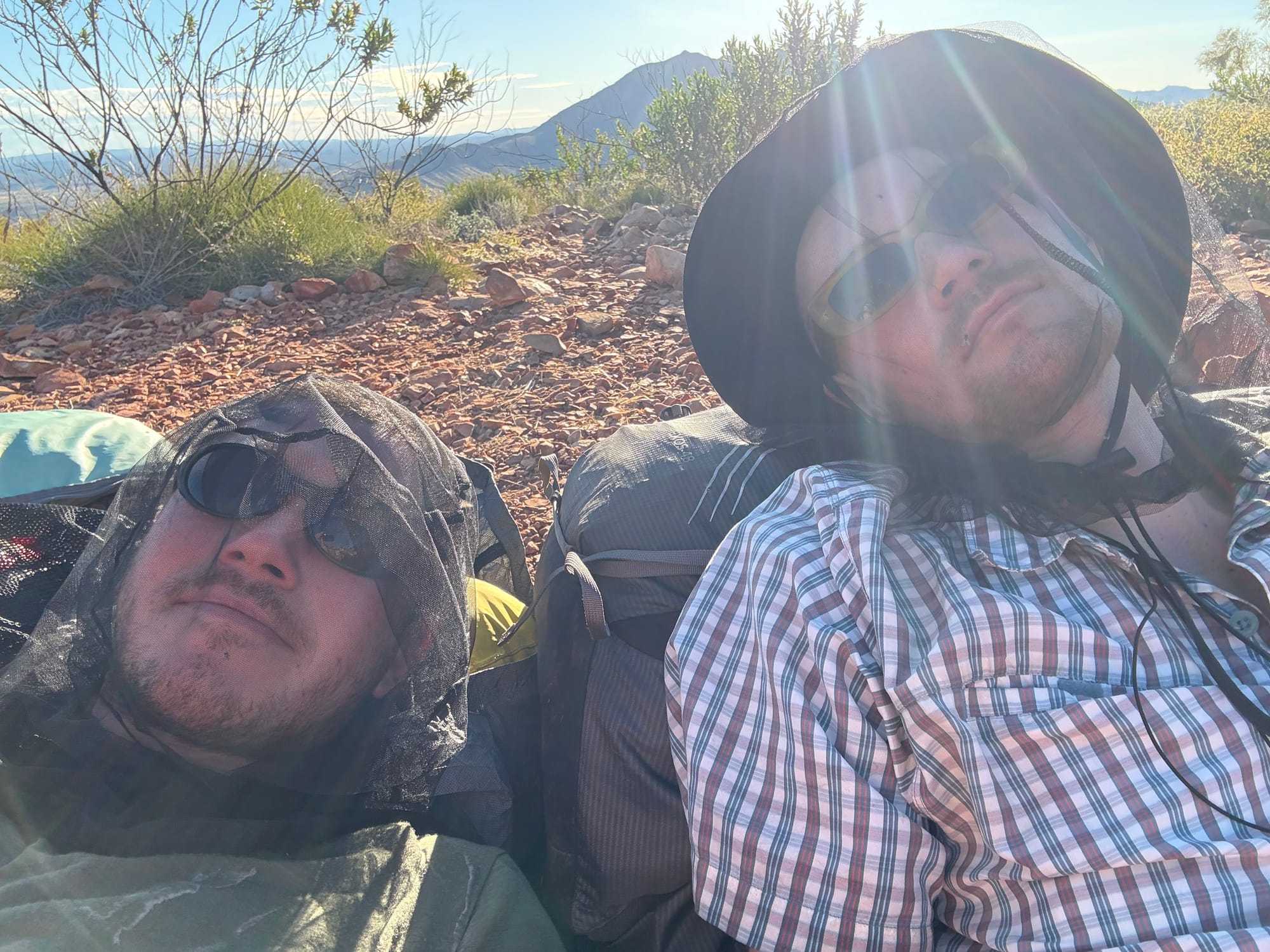
This section is about one of the best afternoons we had of the trip, and probably the best hangout of all time. We were walking about 20km a day, which meant that most days we would arrive at camp with an or or two before dark. This time was spent doing jobs like getting sleeping situation sorted, preparing dinner, tending to foot wounds.
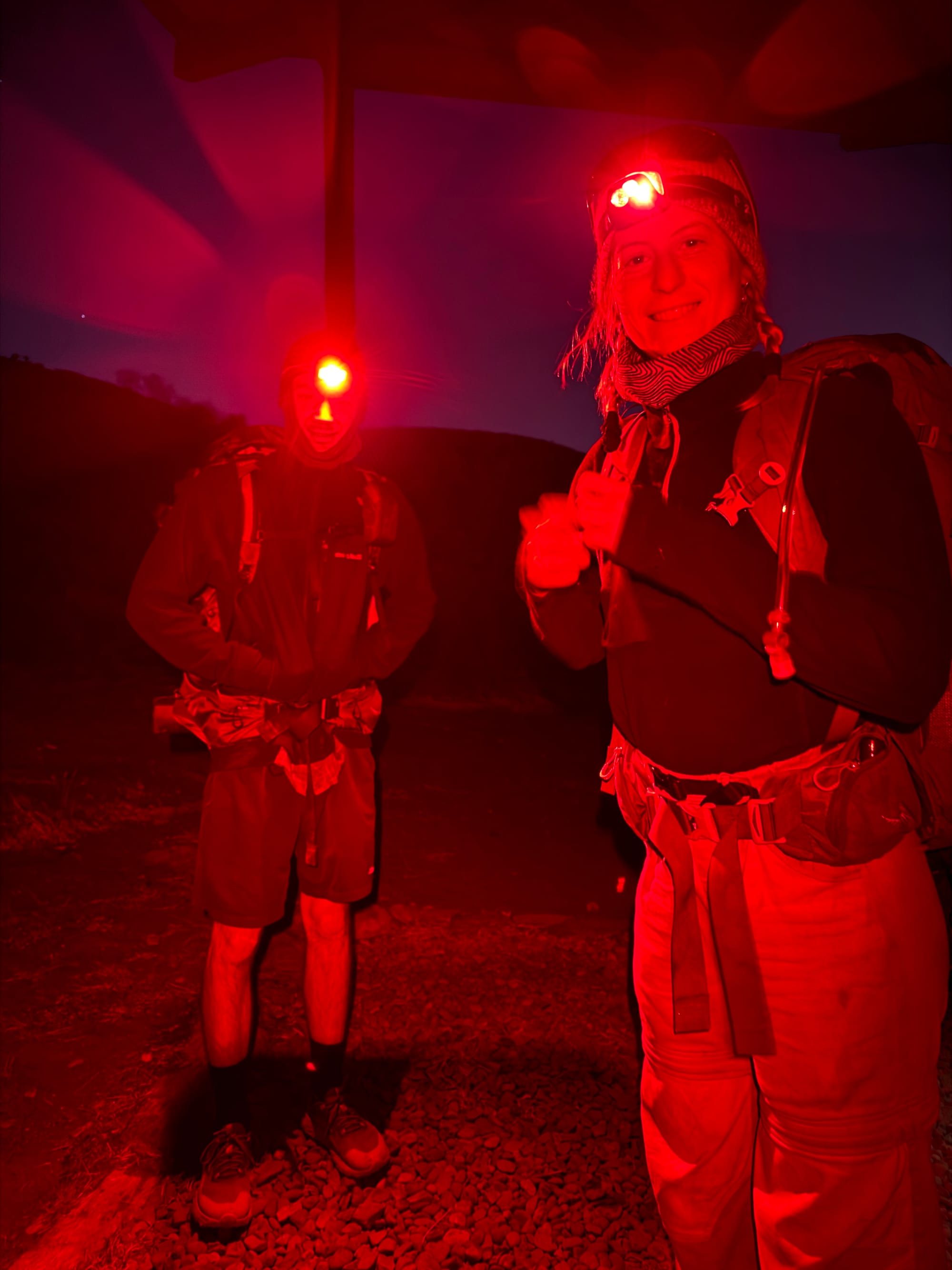
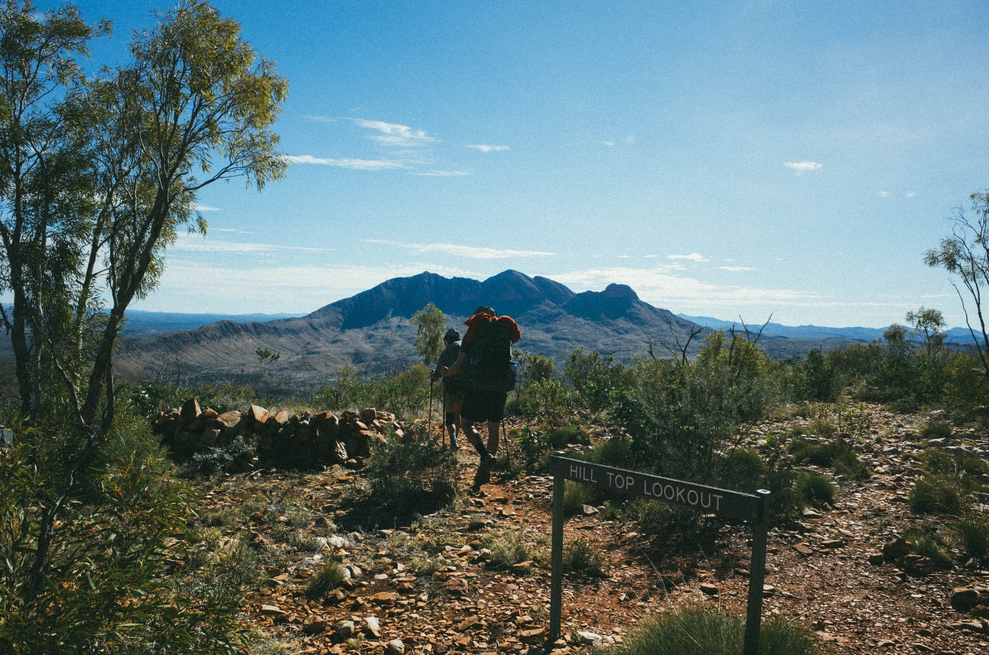
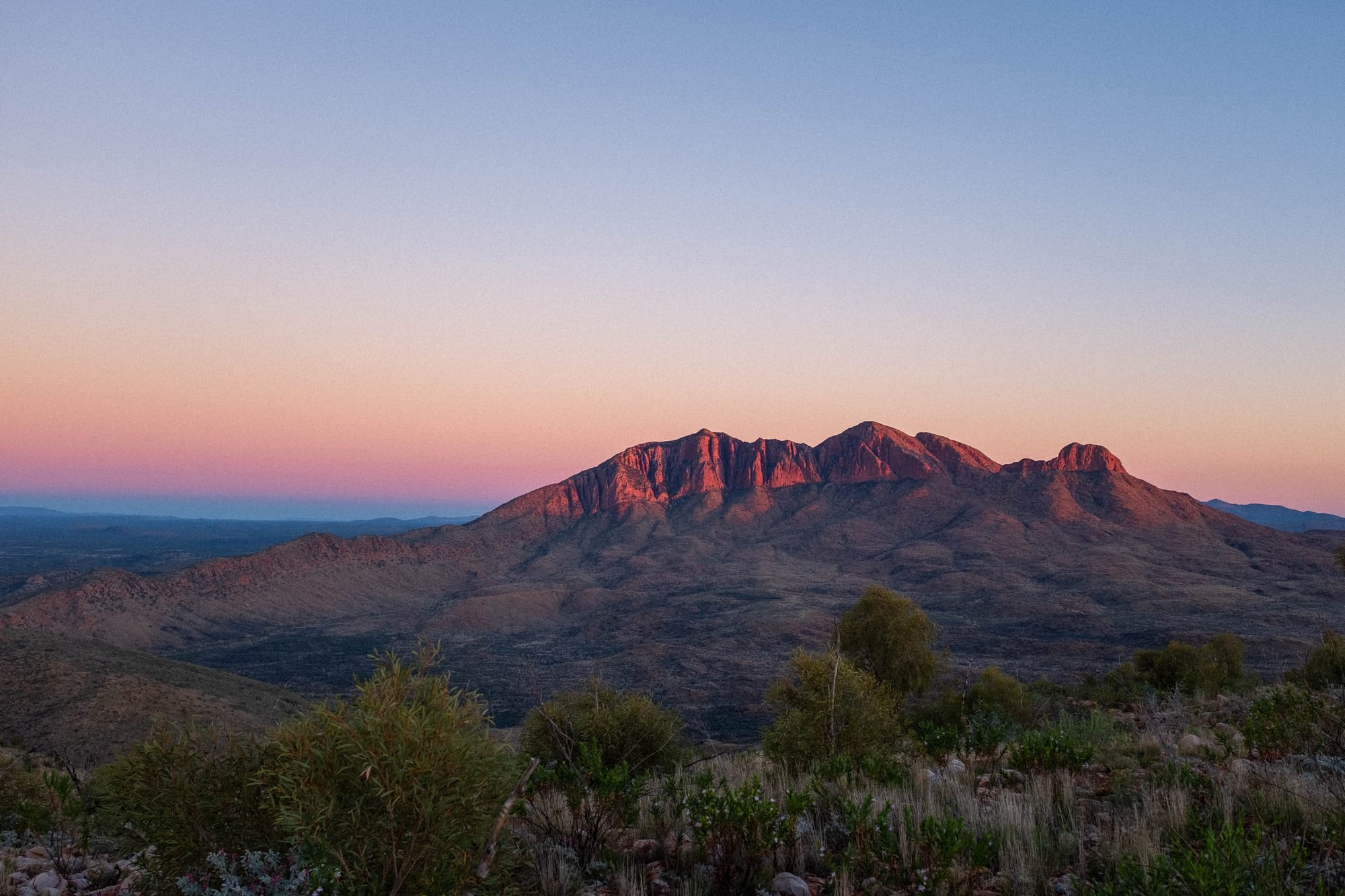
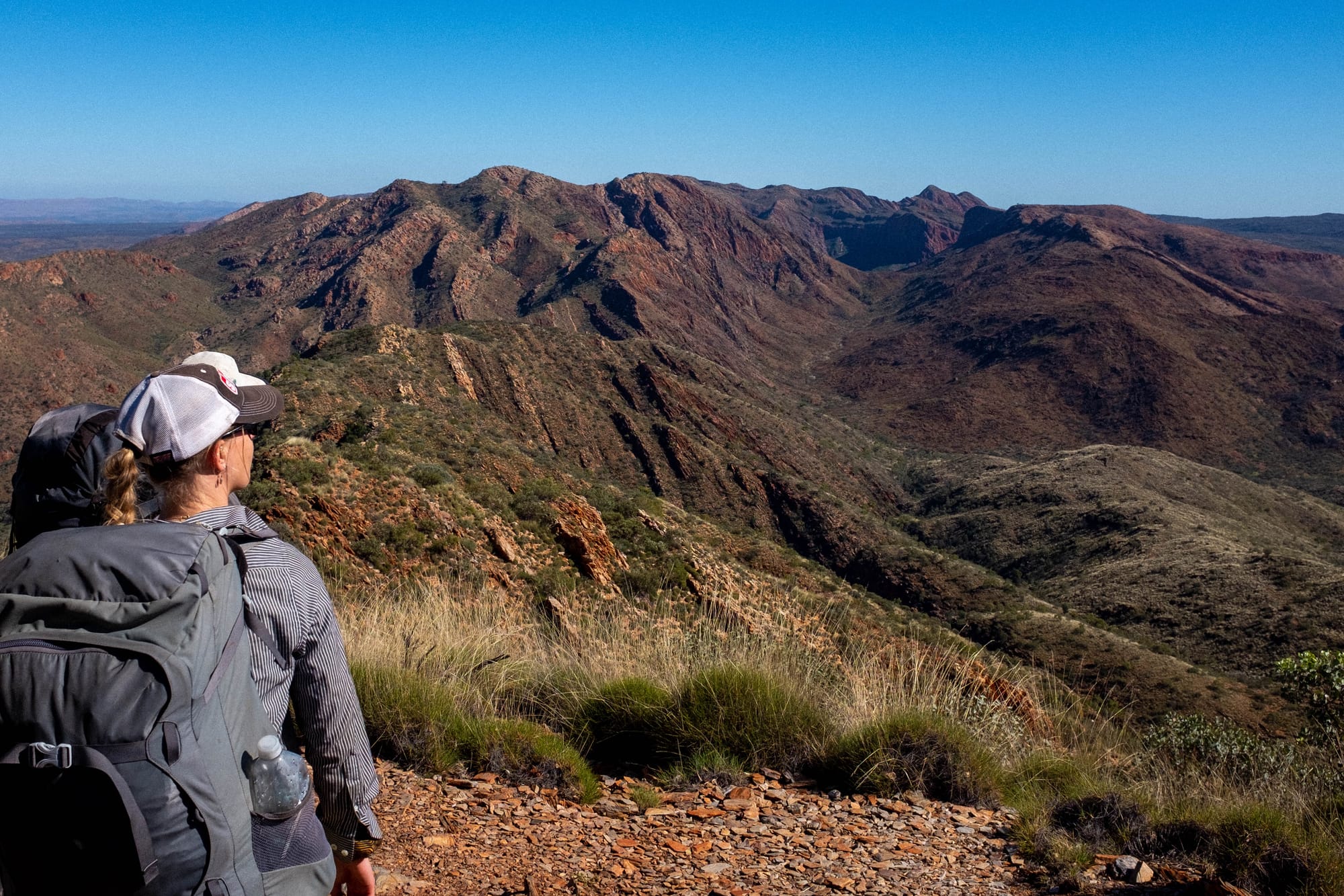
Our walking direction of east (starting in Alice Springs) to west meant that day 13, the final day of the hike, Section 12 of the trail, was climbing to the summit of Mount Sonder. Mount Sonder is the tallest point of the Western MacDonnell Ranges. It is visible on the Larapinta trail from early in the walk, and it cuts quite the figure on the horizon for much of the walk. Typically, on the last day of the trail you wake up before sunrise and do the 7km of walking in the dark and watch the sunrise from the summit.
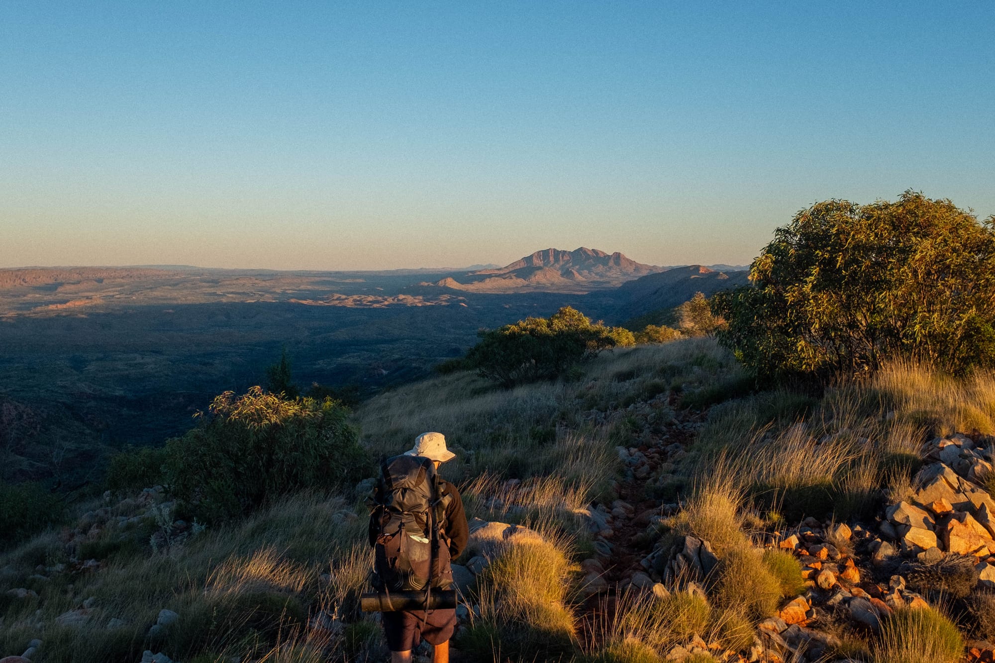
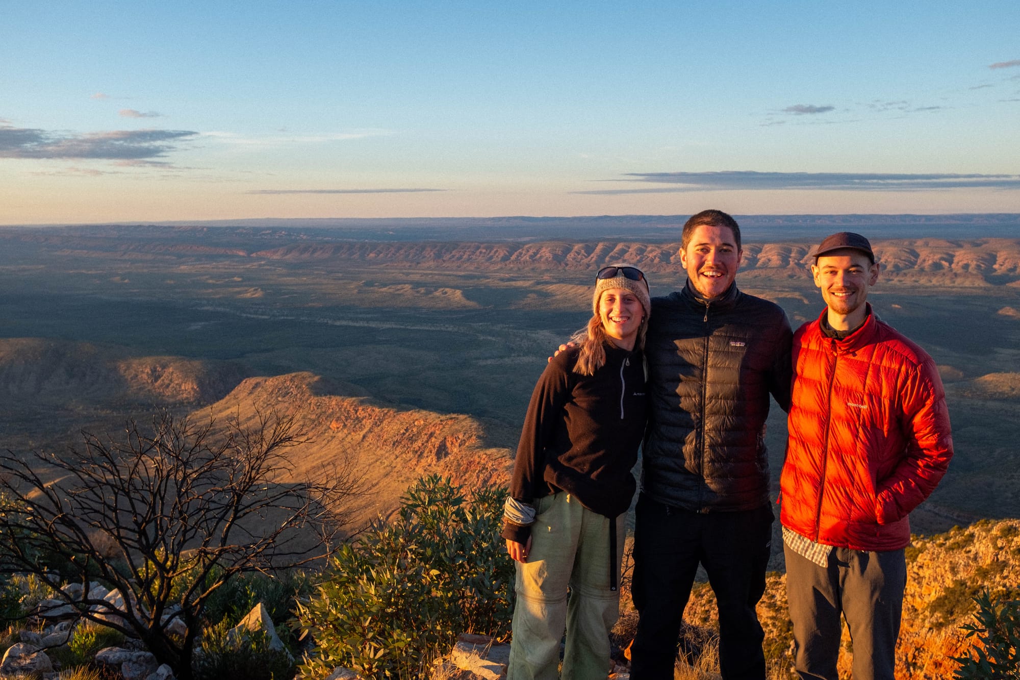
Our program on day 11 had camp at a high camp called Hilltop. We made great progress in the morning and found ourselves arriving at camp early in the afternoon. The special thing about Hilltop is that as well as the amazing sunrise, and sunset viewing and all the usual trimmings of a high camp, it also has a great view of Mount Sonder. So arriving at Hilltop, we were excited that we had arrived so early and had an afternoon off walking, we were excited that we were at a high camp, we were excited that we were so close to Mount Sonder and had a great view of it.
We claimed the largest tent spot we could find (which are always pretty small at the high camps) and committed to one last cowboy camp together for the trip. We laid out groundsheets, and lay around for the rest of the afternoon chatting, reading, napping. The peak of the afternoon was a few rounds of 'queue your favourite chill out song' (that you have saved offline). I think at this point it was Hugh who dubbed the afternoon the ultimate kickback, and I think he was right. The vibes were at an all time high! They just were.
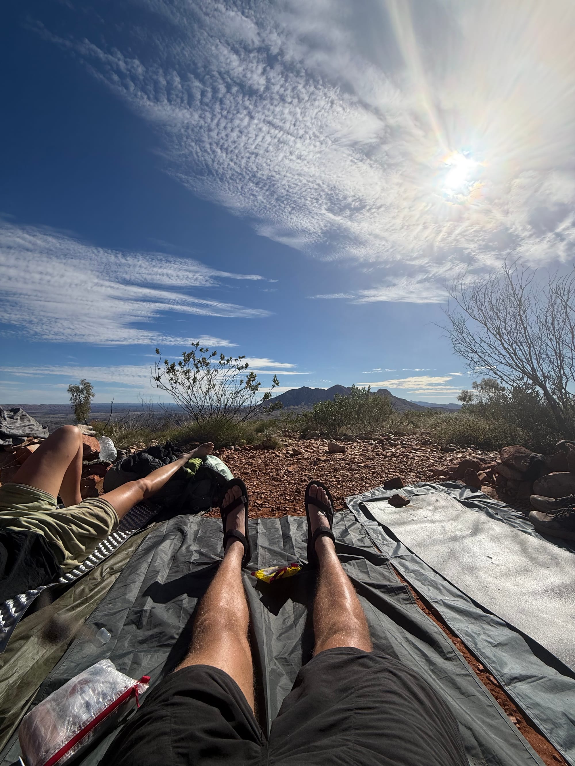
If you want to try and reach the all-time levels of max relax that were reached that afternoon, you can stare at the picture of Mount Sonder below while listening to the songs, saved in a playlist here.
Wrap-up
There's probably a thousand other things I could say about the walk, but saving everyone a 'this happened, then this happened, then this happened' recount, the above are the main things that jump out to me at the moment, 5 days after finishing. I hope that paints a bit of a picture for the great time we had! Special shout-outs to Georgia and Hugh, we made a great team and it wouldn't have been the same trip without either of them. Looking forward to many more hikes in the years to come!
Last few photos below:
Trip Summary
Note for future self and for anyone putting their own Larapinta walk together, see below for the boring X's and O's about where we started and stopped each day, distances and elevation covered. I think in general this route was pretty good, would only make some slight slight changes given we were hit with bad weather near Standley.
East to West - Alice Springs (Telegraph Station to Redbank Gorge)
25/05/2025 - 06/06/2025
13 days walking, 230km total
Day 1 - Telegraph Station to Wallaby Gap
14km | 300m elevation
Day 2 - Wallaby Gap to Mulga Camp
25km | 320m elevation
Day 3 - Mulga Camp to Standley Chasm
23.5km | 520m elevation
Day 4 - Standley Chasm
Rest Day
Day 5 - Standley Chasm to Birthday Waterhole
18km | 640m elevation
Day 6 - Birthday Waterhole to Hugh Gorge
15km | 560m elevation
Day 7 - Hugh Gorge to Ellery Creek North
29km | 320m elevation
Day 8 - Ellery Creek North to Counts Point
21km | 530m
Day 9 - Counts Point to Giles Lookout
22km | 650m elevation
Day 10 - Giles Lookout to Ormiston Gorge
14km | downhill
Day 11 - Ormiston Gorge to Hilltop
18km | 450m elevation
Day 12 | Hilltop to Redbank
16km | flat
Day 13 - Mount Sonder ('Sonder Sunrise')
16km | 710m elevation